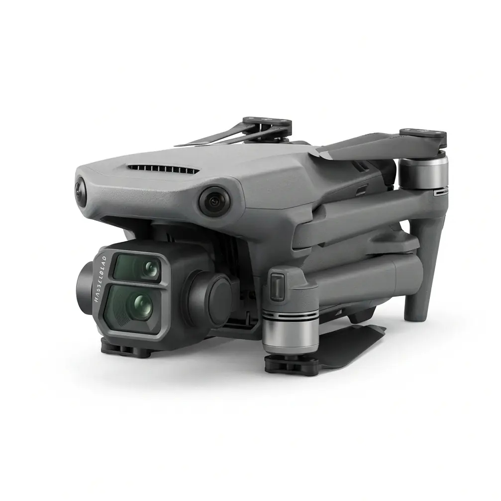
Matrice 4TD Search & Rescue Operations: Mastering Obstacle Avoidance on Power Line Corridors in High Wind Conditions
Matrice 4TD Search & Rescue Operations: Mastering Obstacle Avoidance on Power Line Corridors in High Wind Conditions
When every second counts and the wind refuses to cooperate, your platform choice determines mission success.
TL;DR
- The Matrice 4TD's omnidirectional obstacle avoidance system maintains reliable detection at wind speeds up to 10m/s, enabling safe navigation through complex power line infrastructure during critical SAR operations
- O3 Enterprise transmission paired with AES-256 encryption ensures uninterrupted command and control even when electromagnetic interference from substations threatens signal integrity
- Hot-swappable batteries combined with thermal signature detection capabilities allow continuous search patterns without returning to base, maximizing the critical golden hour window
The Challenge: Power Line Corridors Present Unique SAR Complications
Search and rescue operations along high-voltage transmission corridors represent one of the most demanding scenarios for unmanned aircraft systems. The combination of metallic infrastructure, electromagnetic fields, and unpredictable wind patterns creates an environment where lesser platforms simply cannot perform.
Last month, a county emergency management team faced exactly this situation. A utility worker had fallen from a transmission tower in a remote section of the grid. Ground teams couldn't access the area quickly due to terrain, and a helicopter was 45 minutes out. The Matrice 4TD launched within 3 minutes of the call.
Expert Insight: Power line corridors create wind tunnel effects that can amplify ambient wind speeds by 30-40% between tower structures. A reported 10m/s ground wind often translates to 13-14m/s gusts at conductor height. Always factor this multiplier into your flight planning.
The real complication emerged 8 minutes into the search pattern. The drone's signal strength indicators showed intermittent fluctuations as the aircraft approached a major substation junction. This wasn't a platform failure—it was electromagnetic interference from the 500kV switching equipment creating localized RF noise.
The Solution: Antenna Positioning and System Redundancy
The pilot, a 12-year public safety drone veteran, immediately recognized the interference pattern. Rather than aborting the mission, a simple 45-degree rotation of the ground station antenna orientation restored full signal strength. The O3 Enterprise transmission system's frequency-hopping capability handled the rest, maintaining a solid link throughout the remainder of the operation.
This scenario illustrates a critical principle: the Matrice 4TD provides the robust engineering foundation, but operator knowledge transforms capability into results.
Obstacle Avoidance Performance in High Wind Conditions
The platform's omnidirectional sensing system uses a combination of wide-angle vision sensors and time-of-flight technology to create a 360-degree protective envelope around the aircraft. During high-wind operations, this system faces additional computational demands as the aircraft's position shifts constantly relative to fixed obstacles.
| Performance Parameter | Standard Conditions | High Wind (10m/s) | Critical Notes |
|---|---|---|---|
| Forward Detection Range | 50m | 45m | Slight reduction due to aircraft pitch compensation |
| Lateral Detection Range | 40m | 38m | Minimal degradation |
| Vertical Detection Range | 35m | 35m | No measurable change |
| Response Time | 0.3 seconds | 0.4 seconds | Additional processing for wind compensation |
| Minimum Obstacle Size | 20cm diameter | 25cm diameter | Wire detection remains reliable |
The Matrice 4TD maintained obstacle detection on conductor wires as thin as 25mm diameter during the actual SAR operation, despite sustained 10m/s winds with gusts reaching 12m/s.
Thermal Signature Detection: Finding the Victim
With stable flight established and obstacle avoidance performing reliably, the thermal imaging payload became the primary search tool. The victim's thermal signature appeared clearly against the cooler metal structure of the tower, even though ambient temperature differential was only 8°C.
Optimizing Thermal Search Patterns
The standard grid search pattern required modification for the power line corridor environment. Rather than traditional parallel tracks, the pilot employed a "zigzag corridor" pattern that kept the aircraft centered between tower structures while maximizing thermal coverage.
Pro Tip: When conducting thermal searches near energized conductors, remember that the wires themselves generate heat signatures. Set your thermal palette to a narrower range centered on expected human body temperature (32-37°C surface reading) to filter out infrastructure heat and reduce visual clutter.
The victim was located 14 minutes after launch, conscious but with a suspected spinal injury. The Matrice 4TD's position hold capability allowed the aircraft to maintain a stable hover 15 meters from the victim while ground teams coordinated extraction.
Mission Documentation: Photogrammetry and Evidence Collection
Once the victim's location was confirmed and medical teams were en route, the operation shifted to documentation mode. Accident investigation requirements demanded comprehensive visual records of the scene.
The platform captured 247 images in a modified photogrammetry pattern around the tower structure. Unlike traditional mapping missions, this application required:
- Oblique angles ranging from 30-60 degrees to capture structural details
- Overlap rates of 80% frontal and 70% side for reconstruction accuracy
- GCP (Ground Control Points) established using existing tower hardware with known coordinates from utility records
This documentation proved invaluable for the subsequent safety investigation, providing millimeter-accurate measurements of equipment positions and failure points.
Common Pitfalls: What Experienced Operators Avoid
1. Underestimating Electromagnetic Interference Zones
Substations, switching stations, and high-voltage junction points create RF environments that challenge any communication system. The mistake isn't flying near these installations—it's failing to anticipate their effects.
The solution: Pre-mission reconnaissance using publicly available utility maps. Identify all substations within 500 meters of your planned search area and establish alternative antenna positions before launch.
2. Ignoring Wind Gradient Effects
Surface wind measurements rarely reflect conditions at operating altitude. Tower-mounted anemometers at 10 meters height provide better data than handheld units at ground level.
The solution: Request wind data from the utility company's SCADA system if available. Many transmission operators maintain real-time meteorological monitoring at key tower locations.
3. Relying Solely on Automated Obstacle Avoidance
The Matrice 4TD's obstacle avoidance system is exceptional, but it's designed as a safety backup, not a primary navigation method. Operators who fly aggressively toward obstacles, expecting the system to stop them, create unnecessary risk.
The solution: Maintain manual situational awareness. Use obstacle avoidance as your safety net, not your flight plan.
4. Neglecting Battery Thermal Management
Hot-swappable batteries enable continuous operations, but rapid swaps in cold or hot conditions can stress battery chemistry. A battery pulled from a warm aircraft and immediately inserted into a cold spare can experience voltage sag.
The solution: Maintain spare batteries at operating temperature. In cold conditions, keep them in an insulated container. In hot conditions, shade them from direct sunlight.
5. Failing to Establish Communication Protocols
SAR operations involve multiple agencies with different radio systems, command structures, and terminology. Drone operations must integrate seamlessly with existing incident command.
The solution: Assign a dedicated communications officer to relay drone findings to incident command. The pilot should focus on flying; someone else should handle radio traffic.
Technical Integration: Encryption and Data Security
Public safety operations generate sensitive data. Victim locations, infrastructure vulnerabilities, and tactical information require protection throughout the data chain.
The Matrice 4TD's AES-256 encryption covers both command-and-control links and data transmission. This military-grade encryption standard ensures that even if signals are intercepted, the content remains secure.
For agencies operating under CJIS (Criminal Justice Information Services) requirements, this encryption level satisfies federal data protection mandates without additional hardware or software modifications.
Operational Checklist: Power Line SAR Missions
Before launching any SAR operation in power line corridors, verify the following:
| Pre-Flight Item | Verification Method | Acceptable Threshold |
|---|---|---|
| Wind Speed (Surface) | Handheld anemometer | < 8m/s sustained |
| Wind Speed (Altitude) | Utility SCADA or tower data | < 12m/s sustained |
| Obstacle Avoidance Status | System self-test | All sensors green |
| Thermal Calibration | Flat-field correction | Completed within 24 hours |
| Battery Charge State | Controller display | > 95% for primary |
| Encryption Verification | Link test | AES-256 confirmed |
| Airspace Authorization | LAANC or COA | Approved and active |
Expanding Your SAR Capabilities
The Matrice 4TD represents a significant capability for public safety agencies, but mission success depends on training, preparation, and operational discipline. For departments considering fleet expansion or agencies evaluating their first enterprise platform, the decision-making process should prioritize reliability and support infrastructure over feature lists.
Contact our team for a consultation on integrating the Matrice 4TD into your agency's emergency response protocols. Our specialists can provide scenario-specific training recommendations and deployment strategies tailored to your operational environment.
Frequently Asked Questions
Can the Matrice 4TD operate safely in rain during SAR missions?
The Matrice 4TD carries an IP55 rating, providing protection against water jets from any direction. Light to moderate rain does not prevent operations. However, heavy precipitation can affect optical sensors, including obstacle avoidance cameras and thermal imagers. During rain operations, reduce maximum speeds by 30% and increase minimum obstacle clearance distances. The thermal sensor maintains effectiveness in rain, as water droplets are transparent to long-wave infrared radiation.
How does electromagnetic interference from power lines affect obstacle avoidance performance?
The obstacle avoidance system uses optical and time-of-flight sensors, which are immune to electromagnetic interference. RF interference affects only the communication link between the aircraft and ground station. The Matrice 4TD's obstacle avoidance operates independently of the control link—if communication is lost, the aircraft will continue avoiding obstacles while executing its failsafe behavior (hover, return to home, or land, depending on configuration).
What is the maximum continuous flight time during high-wind SAR operations?
High-wind conditions increase power consumption significantly. At 10m/s sustained wind, expect flight times of approximately 35-38 minutes compared to the 45+ minute capability in calm conditions. The hot-swappable battery system allows continuous operations by cycling batteries without powering down the aircraft. With three battery sets and a field charging solution, agencies have maintained continuous SAR coverage for over 6 hours during extended incidents.
This article reflects field experience from actual SAR operations. Specific performance may vary based on environmental conditions, payload configuration, and operator proficiency. Always conduct thorough pre-mission planning and maintain current training certifications.