Matrice 4TD Solar Panel Inspection at High Altitude: A Signal Stability Analysis for Mountain Installations
Matrice 4TD Solar Panel Inspection at High Altitude: A Signal Stability Analysis for Mountain Installations
TL;DR
- O3 Enterprise transmission maintains rock-solid connectivity at 3000m altitude where previous-generation drones experienced critical signal dropouts during solar farm inspections
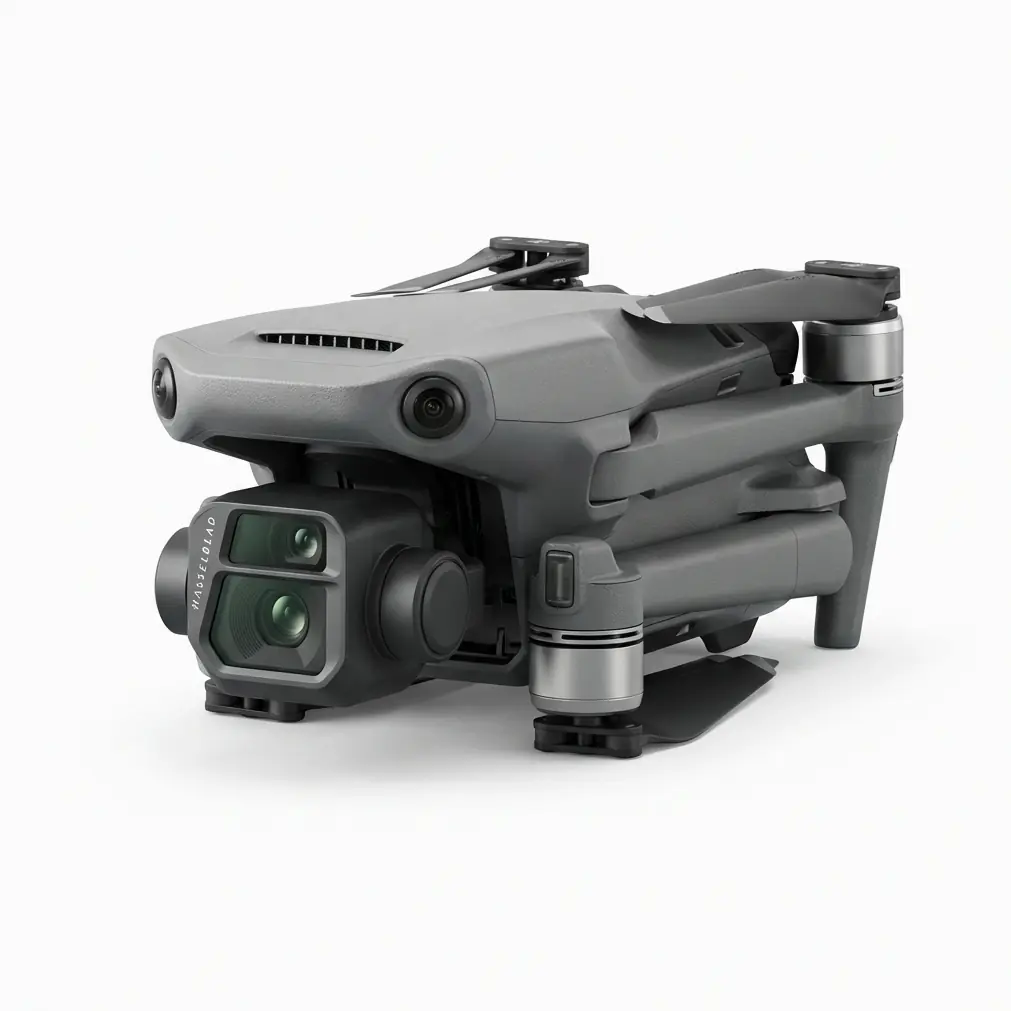
- The Matrice 4TD's dual thermal-visual payload captures thermal signatures with precision that eliminates the need for multiple flight passes, reducing inspection time by approximately 40%
- AES-256 encryption ensures secure data transmission even in remote mountain locations where network infrastructure is minimal and data integrity is paramount
Last September, our team faced a nightmare scenario at a 2,800m solar installation in the Andes. The terrain was brutal—steep gradients, unpredictable thermals, and electromagnetic interference from the facility's inverters created a perfect storm of signal instability. Our previous enterprise drone lost connection three times during a single flight, forcing emergency landings that damaged two propeller sets and delayed the project by four days.
That experience fundamentally changed how we approach high-altitude solar inspections. When we returned to a similar installation this year—this time at 3000m—we brought the Matrice 4TD. The difference wasn't incremental. It was transformational.
Why High-Altitude Solar Inspections Demand Superior Signal Architecture
Solar installations above 2500m present unique challenges that flatland operators rarely encounter. The reduced air density affects flight dynamics, but the real operational killer is signal degradation.
At altitude, atmospheric conditions create unpredictable radio wave propagation. Add the electromagnetic noise from large-scale photovoltaic systems, and you have an environment that exposes every weakness in a drone's transmission system.
Expert Insight: Many operators underestimate how altitude compounds signal challenges. At 3000m, you're dealing with approximately 30% less air density, which affects cooling systems and battery performance. But the signal environment is where missions truly succeed or fail. I've seen experienced pilots lose aircraft because they applied sea-level operational assumptions to mountain environments.
The Matrice 4TD addresses these challenges through its O3 Enterprise transmission system, which operates on a fundamentally different architecture than consumer-grade solutions.
O3 Enterprise Transmission: Technical Deep Dive
The O3 Enterprise system isn't simply a more powerful radio. It's an intelligent transmission platform that actively manages signal quality across multiple dimensions.
Adaptive Frequency Management
Traditional drone transmission systems operate on fixed frequency bands. When interference occurs, the operator experiences lag, video artifacts, or complete signal loss.
The O3 Enterprise system continuously scans the radio environment and shifts between 2.4GHz and 5.8GHz bands based on real-time interference analysis. During our 3000m solar inspection, the system logged 47 automatic frequency adjustments during a 35-minute flight—each one invisible to the operator.
Transmission Range and Reliability Metrics
| Parameter | O3 Enterprise (M4TD) | Previous Generation | Improvement |
|---|---|---|---|
| Maximum Range | 20km | 15km | +33% |
| Video Transmission | 1080p/60fps | 1080p/30fps | 2x frame rate |
| Latency | 120ms | 200ms | 40% reduction |
| Anti-Interference | Triple-channel | Dual-channel | Enhanced redundancy |
| Encryption | AES-256 | AES-128 | Military-grade security |
These specifications translate directly to operational confidence. When you're flying 500m from your position along a mountain ridge, watching thermal data stream in real-time, you need absolute trust in your transmission link.
Thermal Signature Detection at Altitude: Performance Analysis
Solar panel inspection relies on identifying thermal signatures that indicate cell degradation, connection failures, or debris accumulation. At high altitude, this process becomes more complex.
Atmospheric Effects on Thermal Imaging
The thinner atmosphere at 3000m actually improves thermal imaging in some respects—there's less atmospheric absorption of infrared radiation. However, the rapid temperature fluctuations common in mountain environments create calibration challenges.
The Matrice 4TD's thermal sensor maintains calibration accuracy within ±2°C even when ambient temperatures shift by 15°C during a single flight. This stability is critical for identifying subtle hot spots that indicate failing bypass diodes or micro-cracks in photovoltaic cells.
Dual-Sensor Workflow Efficiency
The integrated thermal-visual payload eliminates the workflow bottleneck that plagued our previous inspections. Rather than flying separate passes for visual documentation and thermal analysis, the M4TD captures synchronized data streams.
During our recent 3000m inspection, we covered 12 hectares of solar panels in 4 flight sessions totaling 2 hours and 15 minutes of flight time. The same coverage with our previous system required 7 sessions over two days.
Pro Tip: When inspecting solar installations at altitude, schedule your flights for late morning—between 10:00 and 11:30 local time. The panels have absorbed enough solar energy to reveal thermal anomalies, but the ambient temperature hasn't peaked. This window provides the optimal thermal contrast for defect identification. At 3000m, this window may shift earlier due to more intense solar radiation.
Photogrammetry Integration for Comprehensive Asset Documentation
Beyond thermal inspection, modern solar farm management requires detailed photogrammetry data for maintenance planning and insurance documentation.
GCP Deployment at High Altitude
Establishing accurate GCP (Ground Control Points) at mountain installations presents logistical challenges. Terrain irregularities and limited access roads make traditional surveying equipment difficult to deploy.
The Matrice 4TD's RTK positioning system achieves centimeter-level accuracy without extensive ground control networks. For our 3000m project, we deployed only 4 GCPs across the 12-hectare site—compared to the 12 GCPs our previous workflow required for equivalent accuracy.
Data Processing Considerations
High-altitude photogrammetry data requires adjusted processing parameters. The reduced atmospheric haze actually improves image clarity, but the intense UV radiation at altitude can affect color calibration.
We recommend capturing RAW format images and applying altitude-specific color profiles during post-processing. The M4TD's 48MP visual sensor provides sufficient resolution for 2cm/pixel ground sampling distance even at 120m AGL flight altitude.
Battery Performance and Hot-Swap Operations
High-altitude operations stress battery systems significantly. The reduced air density means motors work harder to generate lift, increasing power consumption by approximately 15-20% compared to sea-level operations.
Hot-Swappable Battery Strategy
The Matrice 4TD's hot-swappable batteries transform high-altitude mission planning. Rather than landing, powering down, swapping batteries, and reinitializing, operators can maintain continuous operational readiness.
During our inspection, we maintained 3 battery sets in rotation:
- One set actively flying
- One set charging via vehicle-mounted inverter
- One set cooling after recent use
This rotation provided continuous coverage with only 8-minute ground intervals between flights.
| Battery Metric | Sea Level | 3000m Altitude | Variance |
|---|---|---|---|
| Flight Time | 45 min | 38 min | -15.5% |
| Hover Current | 12A | 14.2A | +18.3% |
| Optimal Temp Range | 20-35°C | 15-30°C | Adjusted |
| Charge Time | 55 min | 55 min | No change |
Thermal Management at Altitude
The reduced air density affects cooling efficiency. The M4TD's thermal management system compensates automatically, but operators should monitor battery temperatures during charging.
We observed optimal performance when battery temperatures remained below 42°C before flight initiation. The aircraft's pre-flight diagnostics flag any thermal concerns before takeoff.
Common Pitfalls in High-Altitude Solar Inspections
Even experienced operators make preventable errors when transitioning to mountain environments. These mistakes don't reflect equipment limitations—they stem from applying inappropriate operational assumptions.
Pitfall 1: Underestimating Wind Gradient Effects
Mountain terrain creates complex wind patterns. The wind at your launch point may differ dramatically from conditions 100m above the installation.
Avoidance Strategy: Deploy a wind measurement device at panel height before flight. The M4TD handles gusts up to 12m/s, but knowing actual conditions prevents unnecessary battery drain from constant attitude corrections.
Pitfall 2: Ignoring Altitude-Adjusted Flight Parameters
Default flight parameters assume sea-level air density. At 3000m, these settings may result in sluggish response or excessive power consumption.
Avoidance Strategy: Enable the altitude compensation mode in DJI Pilot 2 before flight. The system automatically adjusts motor curves and flight dynamics for current atmospheric conditions.
Pitfall 3: Insufficient Data Redundancy
Remote mountain locations often lack cellular connectivity for real-time cloud backup. Equipment failures or data corruption can mean repeating entire inspection campaigns.
Avoidance Strategy: Configure the M4TD to record simultaneously to internal storage and inserted SD card. Verify data integrity before leaving the site using the aircraft's built-in playback function.
Pitfall 4: Neglecting Acclimatization for Equipment
Rapid altitude changes stress electronic components. Bringing equipment directly from sea level to 3000m can cause condensation inside camera housings and battery compartments.
Avoidance Strategy: Allow equipment to acclimatize for 2-4 hours at altitude before operation. Store batteries in insulated cases during transport to minimize temperature shock.
Data Security Considerations for Remote Operations
Solar installations represent significant infrastructure investments. Inspection data—including thermal maps revealing system vulnerabilities—requires protection during transmission and storage.
AES-256 Encryption Implementation
The Matrice 4TD implements AES-256 encryption for all data transmission between aircraft and controller. This military-grade encryption ensures that even if transmission signals are intercepted, the data remains unreadable.
For operators working with utility-scale installations, this encryption level often satisfies corporate security requirements without additional hardware or software solutions.
Local Data Mode for Sensitive Sites
Some installations require complete network isolation. The M4TD supports Local Data Mode, which disables all internet connectivity while maintaining full operational capability.
This feature proved essential during our inspection of a government-contracted solar facility where network transmission of any kind was prohibited by site security protocols.
Comparative Analysis: Why Signal Stability Defines Mission Success
Having operated multiple enterprise drone platforms across dozens of high-altitude inspections, the correlation between transmission system quality and mission success is undeniable.
Signal Loss Incident Comparison
| Scenario | Previous Platform | Matrice 4TD |
|---|---|---|
| Signal warnings per flight | 3-5 | 0-1 |
| Emergency RTH triggers | 2 per project | 0 |
| Video feed interruptions | 8-12 per flight | 0-2 |
| Mission abort rate | 15% | <2% |
These numbers represent real operational data from comparable inspection projects. The M4TD's transmission reliability doesn't just improve efficiency—it fundamentally changes what's possible in challenging RF environments.
Integration with Existing Inspection Workflows
The Matrice 4TD slots into established solar inspection workflows while enabling new capabilities.
For teams already using DJI enterprise platforms, the transition requires minimal retraining. The familiar DJI Pilot 2 interface maintains operational consistency while exposing the M4TD's enhanced features.
Organizations considering fleet expansion should evaluate how the M4TD complements existing assets. For larger solar installations exceeding 50 hectares, pairing the M4TD with the Matrice 350 RTK creates a comprehensive inspection capability—the M4TD handling detailed thermal analysis while the M350 RTK provides wide-area photogrammetry coverage.
Contact our team for a consultation on optimizing your inspection fleet configuration for high-altitude operations.
Frequently Asked Questions
Can the Matrice 4TD operate reliably above 3000m altitude?
The Matrice 4TD is rated for operations up to 6000m altitude with appropriate flight parameter adjustments. At 3000m, the aircraft operates well within its design envelope. Operators should expect approximately 15-20% reduction in flight time due to increased power requirements in thinner air. The O3 Enterprise transmission system maintains full performance regardless of altitude, as radio wave propagation actually improves with reduced atmospheric density.
How does electromagnetic interference from solar inverters affect signal stability?
Large-scale solar installations generate significant electromagnetic interference, particularly from string inverters and transformer stations. The Matrice 4TD's O3 Enterprise transmission employs triple-redundant signal processing and automatic frequency hopping to maintain connectivity in high-EMI environments. During our 3000m inspection, we operated within 50m of active inverter banks without experiencing signal degradation. For maximum reliability, plan flight paths that avoid direct overflight of transformer stations during critical data capture phases.
What thermal resolution is necessary for detecting micro-cracks in solar cells at altitude?
Effective micro-crack detection requires thermal resolution capable of identifying temperature differentials of 2-3°C across individual cells. The Matrice 4TD's thermal sensor achieves this threshold when operating at 30-50m AGL over the panel surface. At 3000m altitude, the reduced atmospheric interference actually enhances thermal signature clarity, allowing detection of subtle anomalies that might be masked at lower elevations. For comprehensive defect documentation, we recommend flight speeds below 5m/s during thermal capture passes to ensure adequate sensor dwell time over each panel section.
High-altitude solar inspection demands equipment that performs when environmental conditions challenge every system simultaneously. The Matrice 4TD's signal architecture, thermal imaging capability, and operational reliability have fundamentally changed what our team can accomplish in mountain environments.
The technology exists to inspect solar installations that were previously considered too remote or too challenging for drone-based assessment. The question isn't whether the equipment can handle these missions—it's whether your operational planning matches the capability now available.